


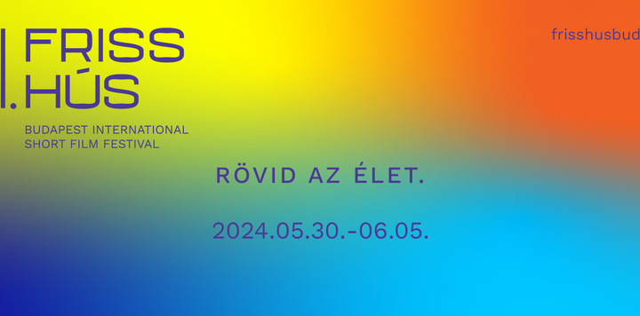
Tervezd újra Buckminster Fuller a Föld felszínét torzulás nélküli síkba kivetített térképét! A Buckminster Fuller Intézet pályázatot hirdetett grafikusok, vizuális alkotóművészek és kartográfusok számára a Dymaxion-térkép újszerű és inspiráló interpretációjának megalkotására. A nyertes 50 példányban kinyomtatott posztert és 50 $ értékű ajándékutalványt kap és New Yorkban megrendezett kiállításon is kiállítják az alkotását. A pályázatok beadási határideje: 2013. június 14. 11:59.
Design the next iteration of the Dymaxion Map. Crowd-sourcing a new map for the Buckminster Fuller Institute. 70 years ago Life magazine published Buckminster Fuller’s Dymaxion Map. With an undistorted projection of the Earth’s surface, ability to be easily reconfigured and transform from a 2-D map to a 3-D globe, the Dymaxion Map (patented in 1946) was a cartographic breakthrough and its iconic design has inspired generations since.
In celebration of the map’s publication anniversary, the Buckminster Fuller Institute (BFI) is calling on today’s graphic designers, visual artists, and citizen cartographers to create a new and inspiring interpretation of the Dymaxion Map. BFI will publish accepted entries within an online gallery, feature the selected finalists in a gallery exhibition in New York City and select one winning entry to be produced as a 36″ x 24″ poster and offered for sale within our online store. *
BFI is seeking submissions across the creative spectrum and will be selecting the winner based on originality, aesthetic beauty and informative qualities. The contest is open to all and will provide entrants with a high-res image to use as ‘canvas’.** Submissions must employ or contain obvious reference to the map’s foundational grid and adhere to specific size and resolution requirements.
Timeline:
April 15, 2013 – Announce Call for Entries
April 22, 2013 – Contest Open
June 14, 2013 – Submission Deadline (11:59 PM EST)
July 12, 2013 – Announce Winners
Fall 2013 – Exhibition of selected Finalists in NYC (details TBA)
Register for the contest here.
FAQ:
Who can enter?
The contest is open to people of all ages and locations.
How will submission be selected?
Finalists and winning entries will be selected by a team of BFI staff and associates based on the following criteria:
- Original. Is the map innovative in some fashion? Does it challenge traditional perspectives?
- Aesthetic. Is the map beautiful? Intriguing? Inspiring?
- Informative. Does the map convey information, worthwhile themes or sets of data to its viewer?
What type and size file should I create?
.jpg or .pdf format, 300 dpi, 36″ x 24″, CMYK.
Once you agree to terms and conditions and complete registration for the contest we will provide you with a high resolution file of the Dymaxion Map for use (available as .psd, .ai, .pdf, or .jpg file). You are also free to create your own Dymaxion Map as long as all final submissions employ or contain obvious reference to the map’s foundational grid and adhere to above size and resolution requirements.
What type and size file should I submit?
.jpg or .pdf format, 72 dpi, no smaller than 1800 x 1200 pixels.
We encourage participants to submit a smaller web and email friendly file for our review process. All selected finalists will be contacted after the submission deadline to submit the high resolution version of their image for printing purposes.
Can I submit more than one image?
Yes, you can submit up to three separate images.
Can I submit a digitally interactive work? Painting? Collage? Sculpture?
Yes. We encourage all creative re-interpretations of the map, and although we are ultimately seeking a 2-D image to produce as a poster, there are possibilites to showcase interactive or 3-d works as well as use scans, photographs, screen shots, link to interactive displays, etc. for publication purposes. Please send an email if you have any questions about this issue.
Wait, what the heck is a Dymaxion Map anyway?
The Dymaxion Map was created by Buckminster Fuller in the 1940’s to accurately project the earth with no visible distortion to land masses, no political boundaries, and no western bias in its orientation. When first printed in Life magazine in 1943 the map could be cut out from the printed pages and arranged in numerous orientations to suit various desires and representation of the earth’s surface. Fuller later settled on a permanent configuration, an icosahedron that broke up none of the land masses and showed the planet as one island in one ocean (see above). This iconic design is what we are interested in using for this contest. Read more here.
Are there any examples of past interpretations of the Dymaxion Map?
Yes! Here are some of our favorite examples of how artists/designers have re-imagined the the map in years past:
- Map (Based on Fuller’s Dymaxion Airocean World), Jasper, Johns, 1967 Fuller-Projection Dymaxion Political World, Tate Modern, 2001
- The Feltron 2008 Annual Report, Nicholas Feltron, 2008 Dymaxion Map, Matthew Day Jackson, 2008
- Recipes from Around the Globe, Sara Mohammadi, 2010 Googlespiel, rehabstudio, Google Developer Day 2011
* The winner will receive 50 copies of the printed poster for personal use and a $50 gift certificate to our online store. All profits generated through our online store go directly supporting programs of the BFI, a 501(c)(3).
** All entrants must agree to terms and conditions specifying terms of use of the map image provided.
Email mapcontest at bfi(dot)org with any other questions you may have.

További cikkek a rovatban
Balázs Béla-pályázat – pályázat íróknak, forgatókönyvíróknak
Deloitte fotópályázat
Innovation Lab 2024 pályázat
Pályázat szabadúszó művészek, művészeti menedzserek, művészeti kollektívák és szervezetek támogatására
Kiállítási pályázat képzőművészek számára
Vásáry Tamás-ösztöndíj pályázat
ART-RAVALÓ pályázat művészeti projektben való részvételre
Ifjúsági Garancia Plusz program
A családi házak energetikai korszerűsítésére tervezett új otthonfelújítási program jelenleg látható részletei
Visa She’s Next program – pályázat a női vállalkozók támogatására
Művészcsere program Budapesten élő és alkotó kortárs művészek, kutatók és kurátorok számára – pályázat
Pályázat sportfotósok számára
Pályázat műemlék épületek állagmegóvására, helyreállítására és felújítására, valamint műemlékek elválaszthatatlan részét képező képzőművészeti alkotások restaurálásának támogatására
MMA Művészeti ösztöndíj
Bicikli- és rollerpályázat fiataloknak
Munkaerőhiány csökkentését célzó pályázat a szállítmányozás és a személyszállítás területén
V. Cinemira Gyerek- és Ifjúsági Film Pitch Fórum forgatókönyv pályázat
Éhes ökovárosok pályázat művészetvezérelt kísérletekre
Barbara Huber Kutatói Ösztöndíj
Pályázat a városi mezőgazdaság fellendítésére Európában és azon túl!
Szabó Dezső Művészeti Ösztöndíj
Pályázat a Balatonfüred – Csopaki Borvidék arculati elemeinek tervezésére
Kikeltető – pályázat zenei tehetségkutatón való részvételre
IMPETUS Accelerator Program – pályázat polgári tudományos projektek megvalósítására